


 • 2008 Explorer Tales Written from the Future")


"It is also popular as the home of smuggled motor vehicles, electronic gadgets, bicycles and other electronic items making it's residents a home-grown businessmen..."
As an aspiring investigative/travel journalist and a TV Documentary Host "wanna be," it makes me so insomniac every night without searching for the reason why this place is called an island which in fact, I didn't see any island when I first visited this place. I need to taper down the anxiety of curiosity. It's weird because when I visited this island the first time,I never crossed a bridge spanning the sea or ride in a boat to reach this so called island. Meaning, this land mass is not detached, so it is not an island.

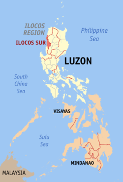 |
| Maps by Wikipedia |
 |
| Location Highlighted in Red |
During low tide and most of the time, this island is not actually an island. It turns to be a peninsula geographically speaking. But when the high tide and when the rain comes, the sea at East and the West coasts of the island meet together, thus, submerging the narrow strip of land that connects it to the mainland making it technically an island. Interesting isn't it?
With this interesting feature, it makes Pinget Island a unique island and a peninsula in one. It has two geographical classifications, an island and a peninsula which is a very rare scenario in the world!
Please do try to analyze the map below so that you can appreciate the interesting feature of this island and then read my explanation below.
There you have the map of Pinget island. Please take note that this island tend not to be totally detached from the mainland.
As you can see at the map, there is a narrow strip of sand that connects it to the mainland.


So, technically it is not totally detached. Now, as you can see, the sea is just around the two sides and when it is high tide and when there is a heavy rain, the two coasts meet together submerging this narrow strip of sand making this place totally detached from the mainland thus an island is created.
Now, that's a clear answer!!!

Thanks to Khamzy for capturing the photo at the left where I was sitting facing the Lapog Bay of San Juan, Ilocos Sur. For travelers don't worry because this is reachable by land but as I was telling, it becomes isolated when there is a typhoon or heavy rain making it an island totally detached from the mainland. Another interesting fact I discovered in this place is that this island is actually a home for thousand individuals making it one of the most populated barangays in Magsingal town.
Yes, Pinget island is an island barangay more popularly known as "Puro" or "Puro Pinget." It is also popular as the home of smuggled motor vehicles, electronic gadgets, bicycles and other electronic items making it's residents a home-grown businessmen because they are selling these goods [Needs citation please]. Puro is much visited not because of fun and leisure but because of commerce and trade.
As I was telling, there are a lot of goods here unloaded by cargo ships being sold by the residents. Senator Panfilo Lacson, when he was still the the PNP chief personally came here to inspect and terminate this illegal trade making it a headline in the national news media. The other thing is that, this island is a fish sanctuary and it is where the first line of fish market exists then being sold to the public markets of several towns in Ilocos Sur province.
The business activity here is so vibrant to the extent that it has it's own gasoline station, grocery store, food manufacturing and some satellite government agencies serving this population-rich and commercially busy island.
 The moment I came here, I used to forget all the things that make the lives of the people in this island go round and round. After a thorough research, I see to it that I must and should enjoy my visit to this island and enjoy the beautiful "side" of it. So, we went to the East coast where a resort is located and where the Lapog Bay is located.
At the middle of the bay just near the coast of this island is a historical landmark and this landmark I am referring to is a World War II ship sunk and left unrescued. Right now, the people in this island are collecting the remains of the ship, I mean, it includes the metals, the accessories, and all the contents of this ship to sell to buyers. So, the ship is gradually disappearing.
Aside from these historical landmarks, and it's rich fish sanctuary, it also supports some forms of marine life like starfish which thrive in this island in big numbers. I personally encountered and touched these starfishes and with my upcoming blog posts, one of the features will be these starfishes I ever encountered.
Well, to end up, I can now see the real identity of this island. And I must say it's identity is simply "unidentified" being so unique, full of twists, with issues and politics with a beautiful seaside and natural treasures and marine ecosystem plus a bit of historical events. It's so complicated. Surely, an unidentified island! It has a lot of identity!
As you can see at the map, there is a narrow strip of sand that connects it to the mainland.
Pinget Island aerial view (courtesy of Philskies.net)
Spot Pinget Island: taken from travelpod.
So, technically it is not totally detached. Now, as you can see, the sea is just around the two sides and when it is high tide and when there is a heavy rain, the two coasts meet together submerging this narrow strip of sand making this place totally detached from the mainland thus an island is created.
Now, that's a clear answer!!!
Thanks to Khamzy for capturing the photo at the left where I was sitting facing the Lapog Bay of San Juan, Ilocos Sur. For travelers don't worry because this is reachable by land but as I was telling, it becomes isolated when there is a typhoon or heavy rain making it an island totally detached from the mainland. Another interesting fact I discovered in this place is that this island is actually a home for thousand individuals making it one of the most populated barangays in Magsingal town.
Yes, Pinget island is an island barangay more popularly known as "Puro" or "Puro Pinget." It is also popular as the home of smuggled motor vehicles, electronic gadgets, bicycles and other electronic items making it's residents a home-grown businessmen because they are selling these goods [Needs citation please]. Puro is much visited not because of fun and leisure but because of commerce and trade.
As I was telling, there are a lot of goods here unloaded by cargo ships being sold by the residents. Senator Panfilo Lacson, when he was still the the PNP chief personally came here to inspect and terminate this illegal trade making it a headline in the national news media. The other thing is that, this island is a fish sanctuary and it is where the first line of fish market exists then being sold to the public markets of several towns in Ilocos Sur province.
The business activity here is so vibrant to the extent that it has it's own gasoline station, grocery store, food manufacturing and some satellite government agencies serving this population-rich and commercially busy island.

At the middle of the bay just near the coast of this island is a historical landmark and this landmark I am referring to is a World War II ship sunk and left unrescued. Right now, the people in this island are collecting the remains of the ship, I mean, it includes the metals, the accessories, and all the contents of this ship to sell to buyers. So, the ship is gradually disappearing.
Aside from these historical landmarks, and it's rich fish sanctuary, it also supports some forms of marine life like starfish which thrive in this island in big numbers. I personally encountered and touched these starfishes and with my upcoming blog posts, one of the features will be these starfishes I ever encountered.
Well, to end up, I can now see the real identity of this island. And I must say it's identity is simply "unidentified" being so unique, full of twists, with issues and politics with a beautiful seaside and natural treasures and marine ecosystem plus a bit of historical events. It's so complicated. Surely, an unidentified island! It has a lot of identity!


Post A Comment: