🇵🇭 TAGUDIN • 2024 Top Tourist Spots, Attractions, Things to Do
Some cool netizens liked, commented, and shared this.

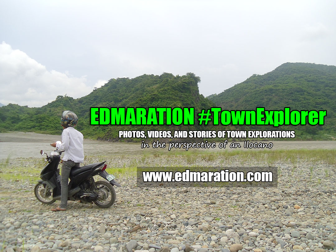
Photos, videos and stories of town explorations.
"Do you want to explore the town of Tagudin in 2023, but you don't have an idea what this town has to offer? You've landed on the right blog."
• Let me help you by writing this Tagudin tourist spots blog. I-share mo ma sa GC niyo, baka makatulong ito. :D
• This article has been updated to fit your 2023 travel goals.
🇵🇭 TAGUDIN, ILOCOS SUR, PHILIPPINES


▼ LIST OF TOURIST SPOTS
▼ OVERVIEW
▼ LATEST UPDATES INDEX
► 2023 List of Best Tourist Spots (Updated)
I have found some interesting tourist spots you may want to see as a visitor or tourist. If you are not a tourist, or if you don't want to be called that way, there are "interesting places" you might want to see. The details I'm going to discuss here are known facts; however, the insights I wrote here were based on my personal experiences, reviews, and perspectives. I hope they'll be helpful. So, here we go!
🟢 #1. BIO VIEW DECK AND CHAPEL • Attractions and Things to Do Here


• What to do here?: Just stand the whole day! Kidding aside, this chapel would give you a great vantage point and a panoramic spot of the boundary of La Union and Ilocos Sur provinces. The beautiful Amburayan River and the Amburayan Bridge would make the view dramatic. If you love viewing a view (equation: view x view = view2), then this chapel with a view deck is the place for you. Few people coming from Manila or elsewhere from the south skip this place, maybe because they are not aware of its existence. Interestingly, this is a nice place to give the tourists a panoramic first glance of Ilocos Sur. Unfortunately, only a few know this. Ngayon, alam mo na ha?
• How to go here?: Just after you cross the Amburayan Bridge, which comes before the Ilocos Sur welcome arch if you are coming from the south, look at your right side. You will see this chapel. Just take the stair uphill. Coming from the north, look at your left, it is located before the bridge.
🟢 #2. AMBURAYAN RIVER • Attractions and Things to Do Here


• Enjoy a panoramic View of the Amburayan River from the Bio Chapel and view deck: A walk away from this elevated chapel is the Amburayan River. As I mentioned above, this chapel atop a hill is a great vantage point to see a panoramic view of the Amburayan River as you enter the province of Ilocos Sur.
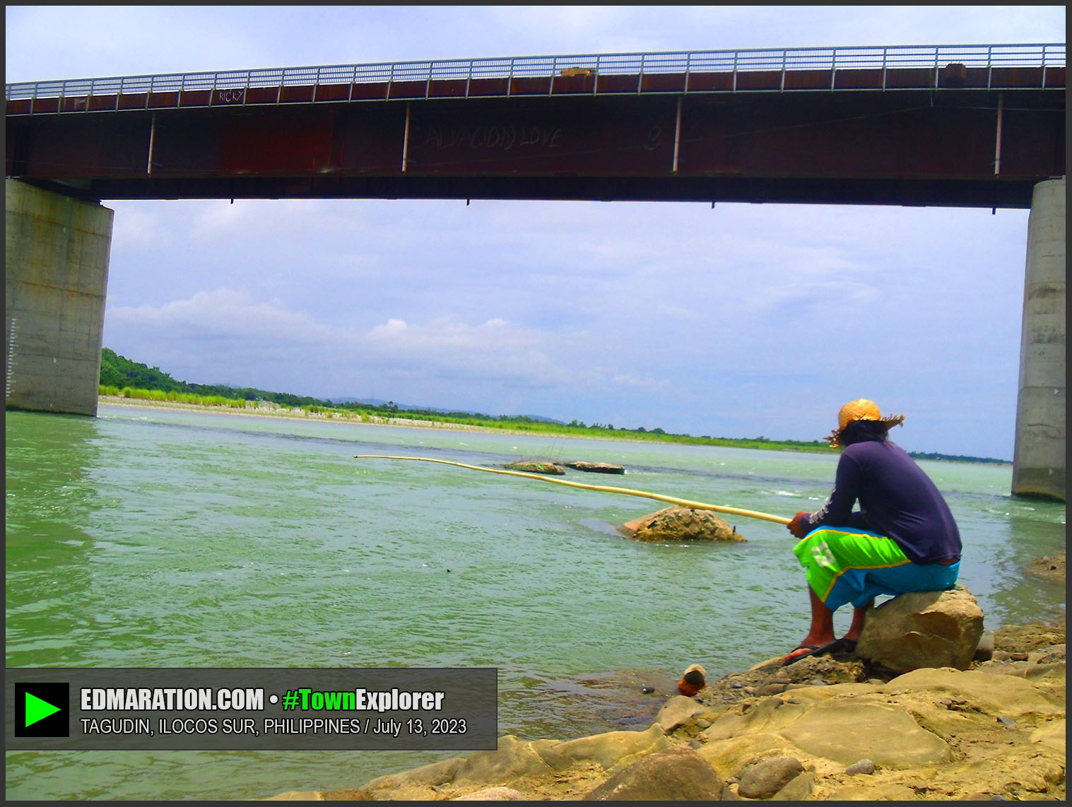
• Amburayan River in Ambalayat: I visited a remote barrio called Ambalayat. In that barrio, the Amburayan River has a different character. I'm not sure if you would consider this as a tourist spot, but I'd be glad to share to you my experience there. A foot bridge connects mainland Tagudin to Ambalayat. If the Amburayan experience at the chapel in Bio is for a panoramic view of the river, this one in Ambalayat is part of the way of life of the people. Villagers do fishing here. There are also islands in this part of the Amburayan River. You could hire a tricycle from the town proper to Ambalayat. That is the most expensive option, so I'd advice that you bring your own motorcycle, or hire one instead to maximize your exploration.
• Cross the River via the Amburayan Bridge: To legitimize your Amburayan River encounter, there's no easier way to do it than to cross this river from La Union to Ilocos Sur using the Amburayan Bridge along the Manila North Road. There is another bridge in Ambalayat that crosses the mighty Amburayan. There are several bridges that cross the Amburayan River in different towns; however, these two are those I've tried in Tagudin so far.
• River fishing: There are no tour operators or tourist facilities that would offer fishing experiences in Amburayan River. However, if you have a local contact here who do fishing, why not join them? Do what the locals do if you are well-versed of river fishing. It could be a cool leisure activity without doing a break dance or breaking the bank.
• Picnicking: You can also have a picnic at the riverbank. There are no officially designated public picnic areas here, but it takes a common sense to find one. You can fish at the river for your meal. If you don't know how to fish, probably because you are suffering from a carpal tunnel syndrome, then just bring your own food. Amburayan River is huge and long; so, in some villages along the river, there are picnic areas made by the locals. Unfortunately, I haven't seen one that is readily accessible and open to public.
• *Semi-cens0red: Swim nµde: Urgh... Swim like you are in a nµde beach, but be sure your body from the waist down should be submerged into the water :p Oh no! Please don't follow this advice, this suggestions is just a product of my playful mind.

🟢 #3. TAGUDIN SUNDIALS • Attractions and Things to Do Here
Tagudin Sundials are Spanish-era structures. The two sundials of Tagudin are the oldest sundials in the Philippines and the only sundial used during the Spanish regime.
• Tell the time using the sundial: The sundials are still working, so don't miss the chance to know what time it is by interpreting the shadows at the sundial. That would be your challenge.
• Don't touch the structure: Don't you ever dare touch the structure. This is part of our heritage and history, and it needs to be preserved. Touching may lead to vandalism. So, prevention is better than cure. If no one will touch it, there will be no vandalism.
• Find the sundials challenge: There are two sundials in town. The one is located in front of the municipal hall, and the other is inside the St. Augustine's School just beside the Tagudin Church. Don't forget to ask for directions from the locals. Do it DIY. Do not rely on your maps or apps. Test how familiar the locals are about a piece of history located in their town.
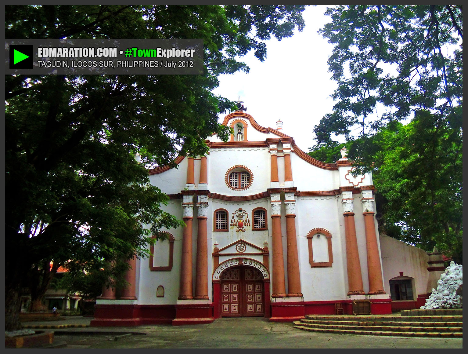
🟢 #4. SAINT AUGUSTINE CHURCH AND BELFRY


Tagudin Church is a must-see historical gem in Tagudin. It has a Baroque architecture and was completed by Fr. Juan Sorolla in 1832. It also has a belfry situated east of the church which was built few meters away from the church as caution for earthquakes.
• How to go here: The church is located at the heart of the town; so, it is very visible and accessible. Going to this church will be as easy as ABC.
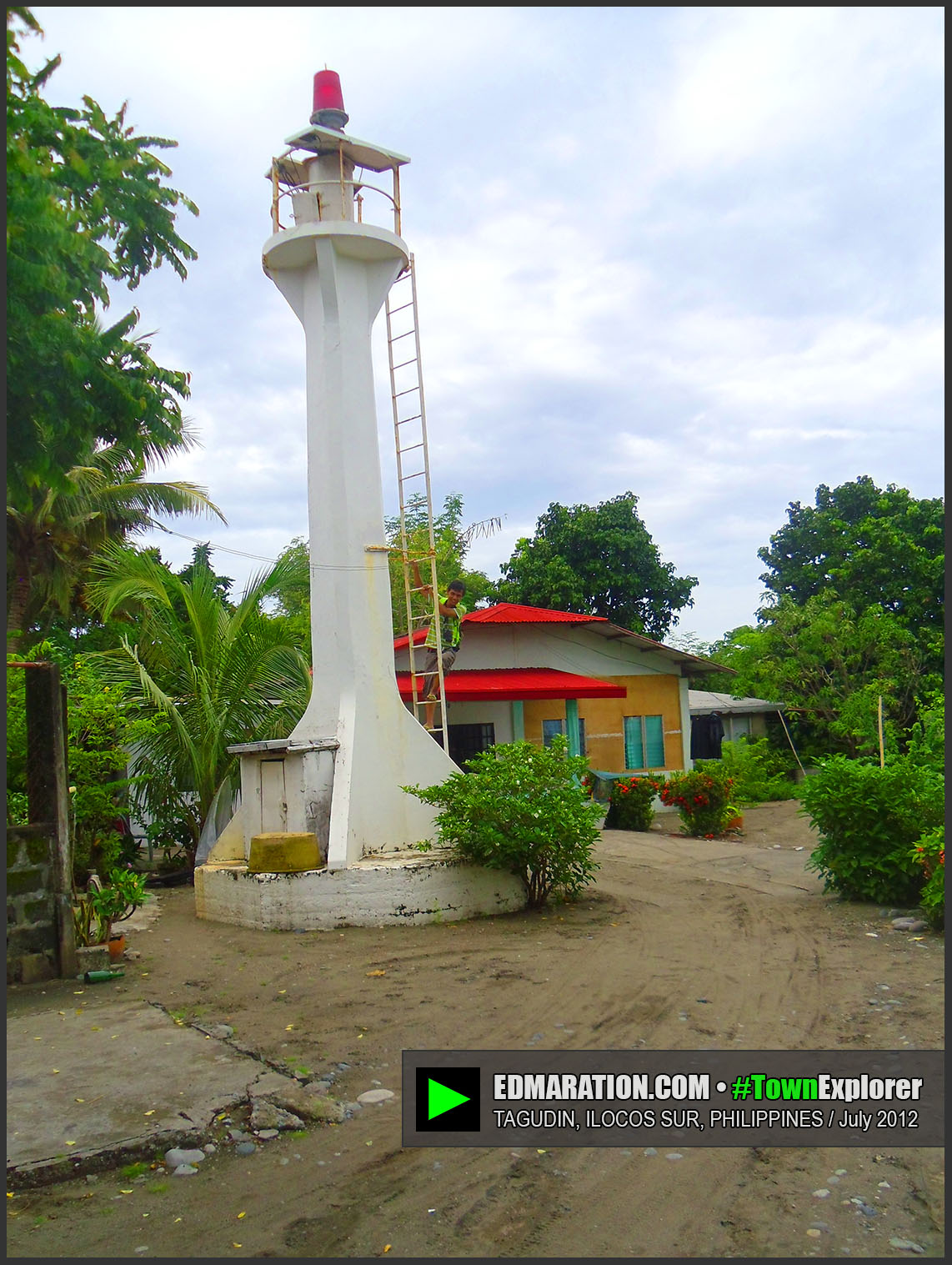
🟢 #5. Farola Lighthouse
Farola Lighthouse is a historical landmark in Tagudin. It has built an Ilocos-Belgium connection, and it is about a hundred years old.
• How to go here: From the Tagudin town hall, get a tricycle; and ask the driver to bring you to the Farola Lighthouse in Brgy Farola. Fare costs about 50-100 pesos. Traveling in group would be much cheaper because of the benefit of sharing. If you have your own vehicle, Farola is located midway the Poblacion and Bitalag. You can ask from the locals for the direction along your way, or refer to your digital maps.

🟢 #6. Farola Beach
So you want a silent beach in Tagudin? There are several beaches, but it is only the Farola beach that I was able to see. It is located near the Farola lighthouse. This beach is the landing site of some Belgian missionaries a century ago. The beach has pebble and dark sand shorelines.
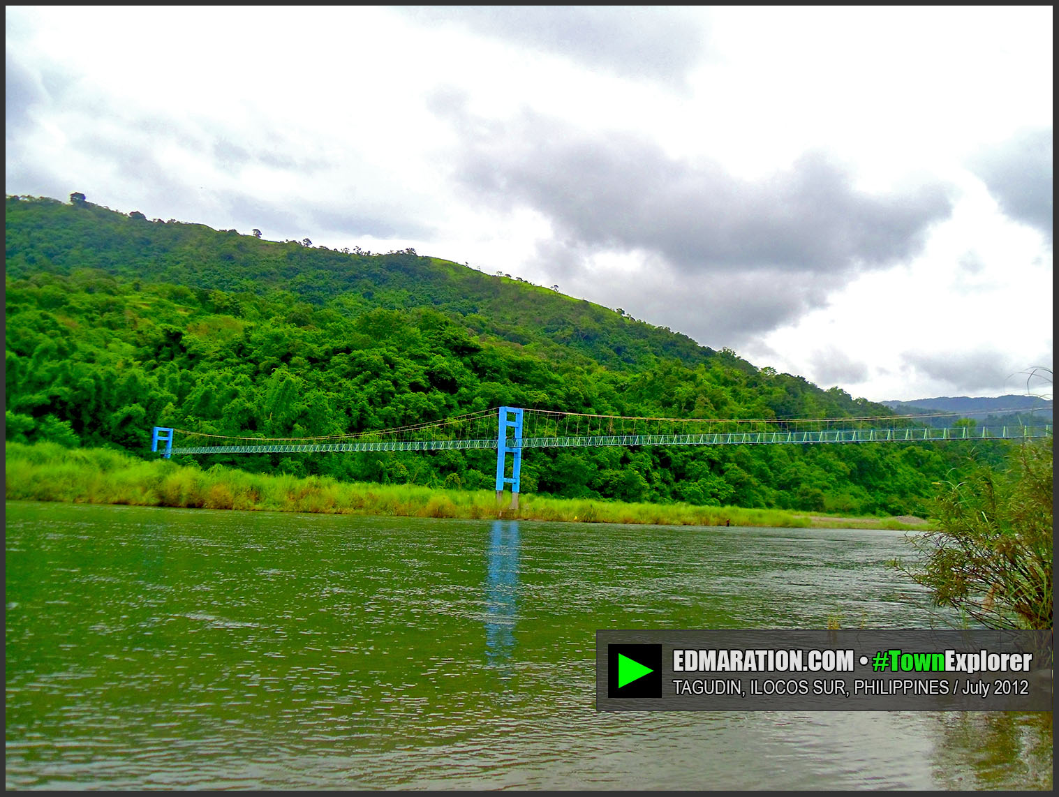
🟢 #7. Ambalayat Hanging Bridge
Go for an adventure and an off-road travel in Tagudin. As I extensively discussed above, this footbridge is located in Brgy Ambalayat, the last barangay in the town at the east separated by the Amburayan River.

🟢 #8. Ilocos Sur Welcome Arch
Legitimize your Ilocos Sur travel by dropping by Ilocos Sur Welcome arch. This is located few meters from the Amburayan Bridge.
► Tagudin Overview

Tagudin is actually an interesting town that could give you history lessons and interesting trivia. It is the first town in Ilocos when you are coming from Manila via land travel.
GATEWAY TO ILOCOS:
Tagudin is the first town that you're going to enter in Ilocos Sur along the Manila North Road coming from Manila. Hence, the grand welcome arch is located in Tagudin.
ESTIMATED TRAVEL TIME AND DISTANCE FROM USUAL ROUTES LEADING TO TAGUDIN.
• From Metro Manila (Balintawak, Quezon City) — Tagudin is approximately 309 kilometers away from Balintawak, Quezon City via North Luzon Expressway (NLEX) and TPLEX. Travel time is approximately 5-6 hours (private vehicle).
• From Baguio City — Tagudin is approximately 106 kilometers away from Baguio City via Naguilian Road (Baguio-Bauang) and Manila North Road (Bauang-Tagudin). Travel time is approximately 2.5-3.5 hours (private vehicle).
• From Vigan City — Tagudin is approximately 93 kilometers away from Vigan City via Manila North Road (Bantay-Tagudin). Travel time is approximately 1.5-2.5 hours (private vehicle).
• From Cervantes, Ilocos Sur — Tagudin is approximately 54 kilometers away from Cervantes via the Tagudin-Cervantes-Sabagan Road (Bitalag Junction-Cervantes). Travel time is approximately 1.5-2.5 hours (private vehicle). Note: Bitalag junction is part of Tagudin.
• From Bontoc, Mountain Province — Tagudin is approximately 130 kilometers away from Bontoc, Mountain Province via the Halsema Highway (BOntoc-Sabagan) and the Tagudin-Cervantes-Sabangan Road (Sabagan-Bitalag Junction). Travel time is approximately 4-5 hours (private vehicle).
► Latest Updates and Visit History Timeline
• 2023-July-13: I passed through Tagudin on this date. So, I took photos of some of the places mentioned in this article. The most recent photos were added including the welcome arch, Bio view deck and chapel, and town proper marker. Distance in between Tagudin and some places were also added.
LATEST STORIES COVERING [TAGUDIN] • SEE ALL IN A SEPARATE WINDOW
MORE BLOGS YOU MIGHT LIKE. SEE TABS BELOW.
▼ ILOCOS SUR
▼ LISTINGS AND DIRECTORY
▼ UPDATED GUIDES AND REVIEWS
► More 'Listings and Directory' Blogs
MORE STORIES COVERING 'LISTINGS AND DIRECTORY' | SEE OLDER STORIES
SC
C
I
P
SQ
V
S
B
A
L
UPDATE HISTORY FOR THIS BLOG POST
• 2024-February-05: Modified some words that may not be appropriate for Google.
• 2023-August-26: Cover photo and carousel lay-out re-arranged.
• 2023-August-07: This post was overhauled and updated. Blog lay-out and format was patterned on my v.2023.1-07/31. Recent photos of Ilocos Sur welcome arch, Amburayan Bridge, and Tagudin town proper marker were added. Information about the Bio view deck was updated. Distance of Tagudin from other places added.
• 2012-December-06: This post was published.
NAGUSTUAM DIAY NABASAM/NAKITAM? MABALIN MO MET I-LIKE.